Concept illustration
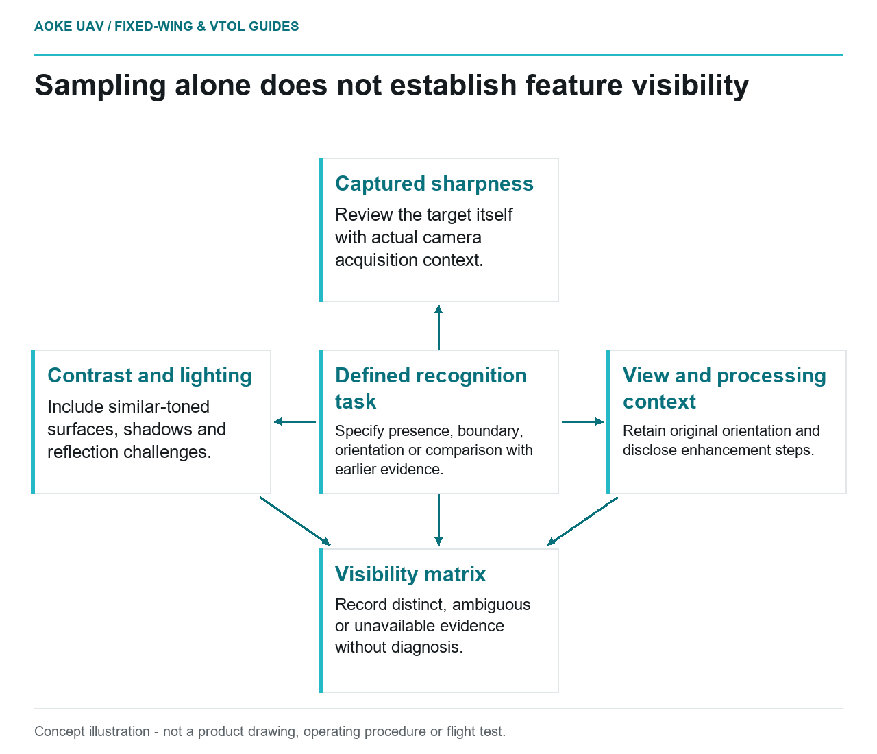
Read diagram notes
- Defined recognition task: Specify presence, boundary, orientation or comparison with earlier evidence.
- Captured sharpness: Review the target itself with actual camera acquisition context.
- Contrast and lighting: Include similar-toned surfaces, shadows and reflection challenges.
- View and processing context: Retain original orientation and disclose enhancement steps.
- Visibility matrix: Record distinct, ambiguous or unavailable evidence without diagnosis.
Sampling versus contrast and sharpness
A feature may occupy image pixels without being distinguishable from its surroundings. In this hypothetical example, an asset owner asks whether a small surface mark can be recognised in imagery from a large fixed-wing civil monitoring flight. The question is visibility, not a calculation of the smallest certifiable defect. Define what the reviewer must distinguish: the mark’s presence, its boundary, its orientation or a change from an earlier record.
USGS calibration guidance explicitly separates ground sample distance from geometric accuracy and discusses radiometric consistency and calibration. [1] That distinction discourages treating a pixel-size label as a complete quality claim. For the proposed feature review, ask for original images showing the relevant surface under representative conditions. An attractive overview image or an enlarged thumbnail is not the evidence the owner requested. Retain the original file and identify the exact region used in review.
Motion during exposure
FHWA’s bridge-UAS research discusses the tradeoff between exposure duration and motion-related blur, as well as the image-quality consequences of changing ISO. [2] These observations support examining acquisition quality, but they are not a fixed-wing camera configuration. The report’s bridge tests and platforms have their own geometries. Do not import their sensor settings as prescriptions for a different, larger aircraft moving past an industrial site.
In this scenario, ask the payload specialist for the actual camera’s exposure and readout documentation, then compare candidate features in the captured frames. A visibly sharp neighbouring edge is useful context, but it should not replace direct review of the target. Record whether the feature is distinct, ambiguous or unavailable. This article deliberately does not calculate a blur budget; its narrower purpose is to test whether the requested evidence remains recognisable after acquisition.
Lighting and surface texture
The same mark should not be assumed visible against every background. For this proposed review, include examples where the mark contrasts clearly, where its tone resembles the surface and where shadow or reflection complicates interpretation. Label those as test conditions, not diagnosed defects. FHWA’s research describes lighting challenges and examples where supplementary lighting improved imagery; it does not establish a universal outdoor lighting recipe for a large fixed-wing observation. [2]
Processing needs its own comparison. Ask reviewers to inspect the original frame alongside any contrast-enhanced crop, with the processing steps disclosed. USGS explains why calibrated data and documented uncertainty help determine whether imagery suits an application. [1] In the hypothetical handoff, enhancement may assist a person’s review, but the team would not present an enhancement-dependent mark as though it had been independently confirmed. Preserve ambiguity when reasonable interpretations remain different.
Viewing direction is another test variable. A requested line or boundary might be partly hidden even when the surrounding surface is well sampled. The proposed acceptance set should therefore include the actual feature orientation rather than only convenient flat targets. For this large fixed-wing assignment, do not resolve a visibility problem by assuming the aircraft can hover beside a structure. If the necessary view is unavailable from the feasible route, that feature remains outside the demonstrated scope.
Verify against the actual inspection task
Agree on a review exercise before claiming capability: specify the target feature class, provide representative originals and ask the asset specialist to state what can actually be observed. Separate presence, identification and diagnosis in the review record. Those are proposed editorial distinctions, not regulatory categories. FHWA describes UAS imagery as supporting inspection and states that imaging does not replace required contact methods or change the underlying inspection requirements. [2]
End with a visibility matrix recording feature, view, image identifier, acquisition conditions, reviewer conclusion and unresolved question. Where visibility is not demonstrated, arrange another evidence method instead of reporting an absence of defects. This preserves a useful role for large fixed-wing reconnaissance while respecting its task boundary. Neither the USGS imagery guidance nor FHWA’s research supplies a general crack-detection threshold for this hypothetical installation, and this article makes no such claim.
Related reading
- Exposure Time and Motion Blur in Fixed-Wing Mapping
- Camera Trigger Interfaces in a Powered Aircraft System