A corridor vegetation question has several parts
Imagine a civil utility corridor crossing pasture, planted woodland and a maintenance yard. A large industrial fixed-wing survey is requested to identify reaches where vegetation deserves further attention. In this hypothetical example, the client wants a maintenance list, while the proposed payload produces images and spectral measurements. The essential editorial distinction is between those observations and the authority to prescribe trimming or other intervention. No GAUTEN project or demonstrated detection result is implied.
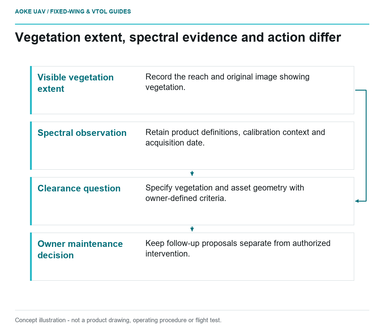
Begin by separating three questions. Where is visible vegetation? What spectral observation was recorded under the acquisition conditions? What evidence is required to decide whether a particular plant conflicts with an asset? Give each question its own output field. A single color-coded priority map should not combine them unless the owner has explicitly defined and validated that relationship.
Treat spectral values as measurements with context
The USGS calibration guide explains that raw digital numbers need radiometric calibration to relate them to quantities such as reflectance. It also discusses consistent units and the calibration information needed to compare datasets. This is support for measurement discipline, not an agronomic diagnosis or a utility vegetation-management threshold. [1]
For the illustrative fixed-wing campaign, request the spectral product definition, band identities, processing version and reference observations before interpreting any index layer. Record whether the values are calibrated measurements or merely display colors. If the provider cannot establish that distinction, retain the layer as an exploratory visualization rather than attaching an operational maintenance instruction to each colored region.
Choose a reference comparison appropriate to the owner’s question. In this example, a field visit could record vegetation type and the feature that prompted attention, while the imagery team checks whether its spectral layer corresponds to the same place and date. Do not describe such a proposed comparison as validation already performed. Seasonal context belongs in the interpretation record, not in an invented universal correction.
Clearance is a geometric and owner-defined question
USGS distinguishes image ground sample distance from geometric accuracy and emphasizes control and verification. Accordingly, a sharp vegetation image alone is not evidence of a verified distance to an infrastructure component. The guide supplies general imagery-quality principles; the required clearance criterion must come from the responsible asset organization. [1]
In the pasture reach, a broad fixed-wing view might support a delineated vegetation extent. In the woodland reach, the owner may instead need the relationship between a canopy surface and a particular asset element. Specify both surfaces and the measurement definition before choosing a sensor. A plan-view overlap flag should remain a proximity screening observation, not a declaration that a regulated separation has been breached.
Ask how the asset geometry was obtained, which inventory revision it represents and whether the vegetation and asset measurements describe compatible conditions. Preserve uncertainty where an asset is hidden or its location is disputed. If the relevant geometric evidence is absent, state that clearance was not assessed. A maintenance list can include a request for measurement without pretending the missing measurement already exists.
Make the maintenance handoff reviewable
For this scenario, propose a record containing corridor reach, visible vegetation extent, source image, spectral product reference, association confidence and owner review status. Keep the suggested follow-up separate from the observation itself. The fixed-wing provider’s role in this example is to supply traceable evidence, not to invent owner policy or authorize a particular intervention.
Suppose a spectral change appears near a service road but the owner reports recent vegetation work. Retain both records and ask whether the imagery predates or follows the intervention. Do not translate the change automatically into renewed growth or distress. The defensible output is a dated observation with a specific interpretation question. That approach preserves the value of broad corridor monitoring without equating an index value, an apparent overlap and a maintenance decision.
Related reading
- Vegetation Indices From Fixed-Wing Imagery: Interpretation Limits
- Power-Line Corridor Overviews and Component Inspection Limits
Sources
Visual summary
Concept illustration
Read diagram notes
- Visible vegetation extent: Record the reach and original image showing vegetation.
- Spectral observation: Retain product definitions, calibration context and acquisition date.
- Clearance question: Specify vegetation and asset geometry with owner-defined criteria.
- Owner maintenance decision: Keep follow-up proposals separate from authorized intervention.