Concept illustration
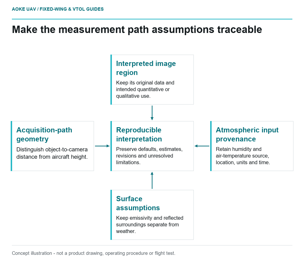
Read diagram notes
- Interpreted image region: Keep its original data and intended quantitative or qualitative use.
- Acquisition-path geometry: Distinguish object-to-camera distance from aircraft height.
- Atmospheric input provenance: Retain humidity and air-temperature source, location, units and time.
- Surface assumptions: Keep emissivity and reflected surroundings separate from weather.
- Reproducible interpretation: Preserve defaults, estimates, revisions and unresolved limitations.
Altitude is not a complete description of a thermal measurement path. In a hypothetical civil monitoring mission, a large fixed-wing UAV records industrial assets from several viewing directions. The analyst receives images but no explanation of the distance or atmospheric settings used. Before comparing temperatures, the team needs to reconstruct what the reported values assume. This is an integration example, not an GAUTEN measurement campaign or a prescribed flight profile.
Atmospheric transmission in the measurement model
FLIR’s measurement chapter explains that the path between object and camera both absorbs target radiation and contributes radiation from the atmosphere. Its distance parameter represents the distance from the object to the front lens. [1] Atmospheric compensation is therefore a defined part of the measurement model, not a generic assurance that software has removed all environmental uncertainty.
For the proposed workflow, ask the payload team which environmental inputs its exact camera or analysis software uses and which values are saved with the image. Keep these questions separate from whether the aircraft can safely operate in the weather. A thermographic parameter set is not an operating authorization or an aircraft limitation document.
Require a traceable description of the measurement path for each interpreted region. If a single value represents a group of observations, state the justification and the intended scope of that approximation. Do not allow a default setting to become an undocumented claim about every asset in a wide image footprint.
Distance and humidity context
FLIR also identifies relative humidity and atmospheric temperature among the inputs affecting thermal measurement compensation. [1] The chapter’s contextual guidance for short paths should not be expanded into an assumption that all airborne distances and atmospheric conditions are negligible.
In the hypothetical fixed-wing dataset, distinguish object-to-camera distance from height above a reference surface. Ask how the relevant distance was obtained and whether it refers to the interpreted asset or a broad mission average. If the geometry cannot support an asset-specific estimate, record that limitation alongside the finding.
For humidity and air temperature, request the observation source, units, location and time. An off-site weather report may be the only available input, but label it accordingly. The point is not to claim a perfect atmospheric description; it is to prevent a reviewer from mistaking an approximate record for a measured condition at the actual path.
Object and background conditions
Do not let atmospheric documentation replace the other parts of the model. Emissivity and reflected apparent temperature remain separate object-related inputs in FLIR’s guidance. [1] A well-recorded weather file cannot establish an unknown surface finish or the radiation reflected by a particular enclosure.
Organize the proposed handover into related but separate records: acquisition geometry, atmospheric observations, surface assumptions and interpretation revisions. The analyst should be able to identify which record supplied each value. Where software permits later changes, retain the original configuration rather than overwriting the only account of the initial processing.
Large fixed-wing datasets may be divided into acquisition segments for this review. Define those segments from available evidence, not simply equal file counts. If conditions or assumptions change, indicate the boundary in the interpretation record. That is a proposed traceability practice, not a universal environmental correction method.
Uncertainty when inputs are unavailable
A missing input does not need a fabricated replacement. Ask whether the intended deliverable can be restricted to locating a candidate observation while quantitative interpretation remains unresolved. If a reviewer must use an estimate, identify its origin and document what additional evidence would be needed to improve it.
For a proposed comparison between near and distant observations, request a validation plan representing both geometries and the actual payload. Do not announce that software-compensated values are equivalent before the evidence exists. The general FLIR chapter provides no installed-aircraft accuracy guarantee and no industrial defect threshold.
The practical outcome is a reproducible record rather than a magically corrected number. A useful fixed-wing monitoring handover keeps original data, acquisition-path assumptions, environmental inputs and limitations together. That lets the asset team decide whether a reported value is suitable for its own method or whether another measurement is needed.