Position solution versus image orientation
A hypothetical large industrial fixed-wing UAV acquires a civil survey with camera positions derived through an RTK or PPK workflow. The proposal treats those positions as proof that the finished map will meet its tolerance. Instead, review exactly what the positioning solution describes and which other parts of the measurement chain remain unresolved. This is an integration evidence review, not a comparison of correction services or an audit of a particular observed trajectory.
USGS describes image self-calibration as estimating camera parameters together with exterior orientation: the sensor’s position and orientation at exposure. [1] A position record therefore addresses only part of that description. For our hypothetical fixed-wing block, request the camera model, applicable calibration information and acquisition geometry alongside the positioning evidence. Do not fill missing orientation or calibration evidence with the mere presence of precise-looking coordinate values.
Timing and lever-arm contributions
Check whether the position belongs to the right event. NovAtel’s OEM7 timed-sensor documentation distinguishes an outgoing trigger request from a returning sensor pulse indicating a measurement, such as camera exposure, and can associate that response with an inertial record. [9] This is a model-specific example, not an instruction to wire an unspecified camera to a receiver. Its relevance is that a commanded capture and the measurement event need not be assumed identical.
Check the spatial reference point as well. NovAtel’s SPAN documentation distinguishes the GNSS antenna phase centre from the IMU navigation centre and requires location and orientation information for additional devices such as cameras. [10] In the fictional large fixed-wing installation, request the measured antenna, navigation-unit and camera relationships. A coordinate labelled “precise” should not silently be treated as the camera’s exposure-centre position unless the applicable processing chain establishes that meaning.
Calibration and adjustment assumptions
For metadata provenance, the RedEdge-MX Revision 04 guide provides another bounded example: aircraft GPS supplied through its API can replace the DLS 2 GPS information written into imagery. [3] That behaviour belongs to the cited model and revision. For our survey, require a record of which source populated the geotags and which transformations were applied; do not infer that the displayed metadata came from the receiver the proposal happened to mention.
Create an uncertainty register for the proposed integration. Separate position-solution evidence, measurement timing, spatial offsets, camera orientation and image calibration. Give each item a responsible reviewer and a record that can substantiate it. Retain the position-quality information delivered by the actual workflow, but do not use it as a blanket uncertainty value for the entire map. This register is an editorial review method; no numerical error budget has been computed for a real aircraft.
Independent evidence at the final product
USGS treats camera calibration, acquisition geometry, ground control and quality verification as interrelated; it also distinguishes validation observations from those used in calibration in its cross-validation example. [1] For this hypothetical project, specify a final-product assessment independent of the inputs used to adjust it. The existence of high-quality geotags should not be reported as if it were that assessment, and adjustment residuals should retain their actual role.
At handover, keep the geotag provenance and integration records connected to the delivered map version. State which uncertainties were assessed, which remain open and what independent measurements support the requested civil use. If evidence is missing, qualify the relevant claim instead of promoting input quality into a survey guarantee. The practical benefit of this fixed-wing review is a complete chain of questions from the recorded camera position to the accepted product, without inventing field results or dismissing useful positioning technology.
An illustrative chain-of-evidence record would connect an image identifier to its measurement event, the position solution used, the declared output reference point, the applied spatial transformation and the adjustment version. A missing link should be visible even when the positioning record has a favourable quality flag. The purpose is not to repeat a full trajectory audit, but to show whether the geotag being claimed as evidence actually belongs to the camera observation used in this mapping product.
Related reading
Sources
- [1] Guidelines for Calibration of Uncrewed Aircraft Systems Imagery
- [3] MicaSense RedEdge-MX and DLS 2 Integration Guide
- [9] Adding timed sensor triggers
- [10] SPAN translations and rotations
Visual summary
Concept illustration
Read diagram notes
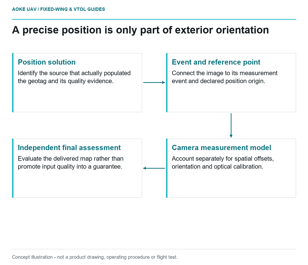
- Position solution: Identify the source that actually populated the geotag and its quality evidence.
- Event and reference point: Connect the image to its measurement event and declared position origin.
- Camera measurement model: Account separately for spatial offsets, orientation and optical calibration.
- Independent final assessment: Evaluate the delivered map rather than promote input quality into a guarantee.