Concept illustration
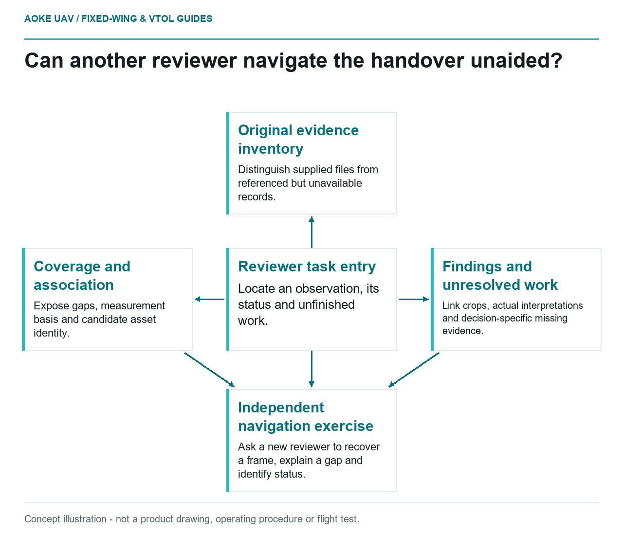
Read diagram notes
- Reviewer task entry: Locate an observation, its status and unfinished work.
- Original evidence inventory: Distinguish supplied files from referenced but unavailable records.
- Coverage and association: Expose gaps, measurement basis and candidate asset identity.
- Findings and unresolved work: Link crops, actual interpretations and decision-specific missing evidence.
- Independent navigation exercise: Ask a new reviewer to recover a frame, explain a gap and identify status.
Design the package around a reviewer’s next task
A hypothetical civil infrastructure owner receives a polished report after a large industrial fixed-wing corridor campaign. The report contains maps and selected observations, but the owner also needs to investigate disputed locations and plan follow-up work. The handover should therefore make the supporting evidence recoverable without requiring the original analyst to explain every page. This is an illustrative package design, not an GAUTEN delivery or a certification template.
Begin with the decisions the client expects to make: locate an observation, assess whether its evidence is usable, understand its review state and identify unfinished work. Define a package structure around those tasks. A report can summarize the work, but it should not be the only surviving connection between the imagery and the asset record.
Inventory originals and their measurement context
USGS imagery guidance emphasizes calibration information, processing documentation and metadata for assessing data quality and enabling reuse. It includes sensor configuration, measurement time, viewing geometry and projection among relevant categories. These are imagery-research principles, not a mandatory civil inspection deliverable standard. [1]
For the proposed fixed-wing package, include a file inventory that identifies original frames, navigation or event records used by the method, calibration references and derived products. Distinguish files actually supplied from items referenced but unavailable. Preserve original identifiers when creating more readable delivery names so the relationship does not depend on a fragile filename convention.
Add concise explanations of the actual processing versions and reference systems. If a product uses a particular optical or mount configuration, link the applicable record rather than attaching an unrelated generic calibration file. Do not claim that an inventory entry verifies the file’s scientific suitability; it first establishes what evidence the reviewer has received and where it belongs.
Deliver usable coverage and associations explicitly
Include a coverage record matched to the owner’s observation units, not only the planned route. In the illustrative corridor, mark which asset surfaces have usable views and which questions remain unobserved. Link a missing observation to its reason and proposed disposition. Keep a no-finding record distinct from a gap so the client cannot mistake missing evidence for evidence of sound condition.
USGS cautions that image ground sample distance does not directly establish geometric accuracy and describes independent checks as validation evidence. Where the handover includes coordinates or dimensions, supply their method and actual quality evidence rather than relying on a nominal pixel-size claim. A civil owner should be able to distinguish a photo index from a verified measurement product. [1]
For every association, retain the observation ID, candidate or confirmed asset ID and inventory version. Document whether identification was reviewed visually, derived geometrically or left uncertain. Do not silently update the owner’s master asset locations within an evidence handover; disputed associations belong in a review layer with an explicit decision trail.
Make findings and limitations independently navigable
Propose a findings index that points from each reported item to the original evidence and any displayed crop. Record its description, interpretation, creator type and actual review status. If a specialist has not reviewed an item, leave that status unconfirmed. Report styling, signatures inserted by a template or a brand label should not imply inspection certification.
Keep an unresolved-work register beside the findings index. It should identify the missing evidence, intended decision and responsible party where known. In this scenario, a concealed service structure may need another method while a disputed coordinate may need a reference check. Those are different follow-up tasks and should not be hidden in one general limitations paragraph.
Finally, test the package with a reviewer who did not prepare it. Ask that person to recover one original frame, explain a coverage gap and determine the status of a finding using only the delivered files. This is a proposed acceptance exercise, not a test result. If the path fails, revise the package before handover. The fixed-wing deliverable becomes useful evidence when the client can navigate its claims and limits, not merely admire its final report.
Related reading
- Metadata Handover for Fixed-Wing Survey Projects
- A Propulsion Supplier Evidence Checklist for Industrial UAVs