Pixel footprint and image geometry
A hypothetical fixed-wing mapping proposal advertises exceptionally fine pixels over a large civil works site. The appropriate response is not to reject the camera, but to ask which claim those pixels support. USGS distinguishes ground sample distance from the accuracy of UAS imagery and cautions against treating smaller GSD as higher positional accuracy. [1] The proposal must therefore describe image sampling and final-product accuracy separately.
Use two questions in the proposal review. First, what ground detail is sampled in the planned images? Second, how closely will coordinates extracted from the delivered product agree with suitable independent reference measurements? The first question helps discuss image detail. The second requires an actual assessment. In this example, do not fill an accuracy field by copying a GSD value, and do not turn a nominal pixel footprint into a confidence statement.
Calibration and control contributions
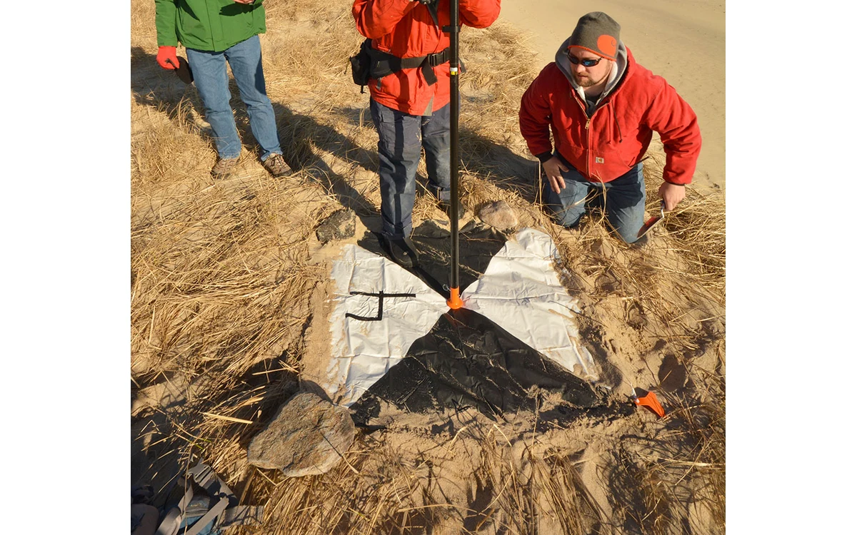
USGS identifies ground control accuracy and distribution, flight configuration, camera calibration and tie points as parts of geometric data quality. Its self-calibration discussion explains that image processing estimates camera parameters together with exposure position and orientation. [1] This is why a detailed image can still leave unresolved questions about where a feature belongs in the project reference frame. More pixels do not replace checking that complete measurement chain.
For the large industrial fixed-wing installation, request an acquisition rationale rather than a resolution slogan. Have the team identify the installed camera and lens configuration, how calibration will be handled, and how the proposed strips support the adjustment. Ask how the camera mounting and project extent will be represented in the records. These are proposed evidence requirements; they do not establish that any particular aircraft, lens or processing package has achieved the client’s tolerance.
Independent checkpoints and reporting
Keep adjustment observations distinct from assessment observations. In its cross-validation example, USGS uses a subset of ground points for calibration and treats the remaining points as validation points for that trial; it also notes that checkpoint accuracy limits how well data quality can be validated. [1] A small discrepancy at a point used to constrain the solution should not be presented as independent confirmation of the resulting map.
In the hypothetical acceptance plan, identify where independent checks are needed across the large fixed-wing survey block. Ask whether they represent the edges, elevation differences and areas of operational interest rather than only an accessible launch-site corner. Record how reference positions were measured and which coordinate transformations were applied. If access prevents a meaningful assessment in part of the site, describe that limitation instead of borrowing confidence from better-observed ground elsewhere.
Describe accuracy without false precision
Write the final specification so a reader can distinguish proposed performance from measured results. Put nominal image sampling in its own field. Put the required assessment method and contractual tolerance in separate fields. Reserve observed accuracy figures for the completed assessment, with the relevant reference measurements and product version. In this fictional proposal no checkpoint results exist, so the honest output is an evidence plan, not a fabricated error statistic.
USGS presents its geometric guidance in a research and calibration context, including particular experimental flight patterns; those examples are not universal large-aircraft operating instructions. [1] The fixed-wing team still needs applicable aircraft documentation and a project-specific survey method. When comparing proposals, prefer the one that makes those dependencies inspectable. Fine GSD can remain a useful acquisition objective, but only properly scoped final-product checks can support the separate accuracy claim being requested.
A useful proposal comparison sheet would place each fixed-wing option on the same evidence basis: nominal sampling assumptions, installed camera configuration, calibration approach, reference-observation plan and final-product assessment. Leave unmeasured performance blank rather than treating a vendor’s most detailed image as a benchmark result. The reviewer can then identify whether competing proposals differ in the measurement they promise or merely in the pixel size highlighted on their first page.
Related reading
Sources
Visual summary
Concept illustration
Read diagram notes
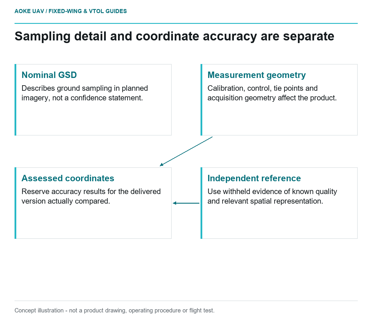
- Nominal GSD: Describes ground sampling in planned imagery, not a confidence statement.
- Measurement geometry: Calibration, control, tie points and acquisition geometry affect the product.
- Independent reference: Use withheld evidence of known quality and relevant spatial representation.
- Assessed coordinates: Reserve accuracy results for the delivered version actually compared.